DeepAI

Answering billions of questions for more than 5% of Americans!
DeepAI is the all-in-one creative AI platform built for everyone. We got our start in late 2016 with the first browser-based text-to-image generator (and some other generative tools). Since then, we have greatly expanded: with a single prompt, you can generate images, edit photos, chat with an AI that browses the internet, create short videos, compose original music, or chat with a realistic AI using your voice. All of these features are available instantly in your browser, and many are available through simple APIs.
You can explore DeepAI for free without creating an account. DeepAI Pro costs $9.99 per month and includes high-volume usage, private generations, and an ad-free experience, which we proudly feel is one of the best deals on the market.
We are committed to radical accessibility. Our platform provides fast tools, real email support for every user, and a clear policy that gives you full ownership of everything you create. Whether you are a hobbyist, a professional artist, or a developer integrating AI into your product, DeepAI delivers advanced technology with new video, music, and voice chat features. No competitor matches our combination of price, features, and ease of use.
Beyond our consumer platform, we also take on custom technical projects for governments, nonprofits, and research organizations. Our team builds specialized computer vision systems, deploys perception and mapping pipelines across complex sensor networks, and solves challenging real-world problems that require production-grade AI solutions. If you have a unique technical challenge, we're equipped to help.

Beyond making AI accessible to creators worldwide, we believe in using our technology to solve real-world problems and support communities in need. Our "AI for Good" initiative reflects our commitment to environmental stewardship, conservation, and social impact.
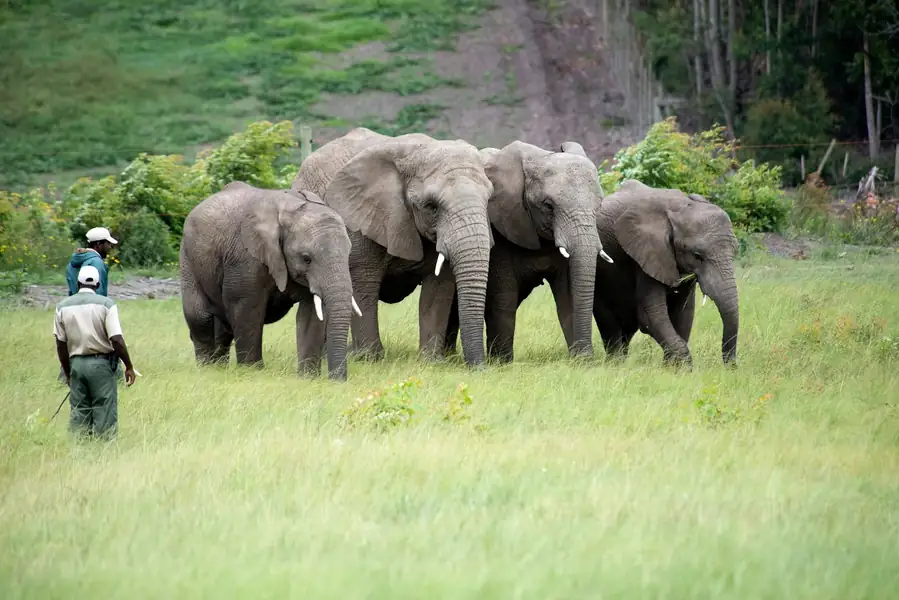
We've deployed advanced computer vision and sensor systems for critical conservation projects across the globe. Our technology analyzes satellite imagery, drone footage, aerial photography, and camera trap data to protect biodiversity and monitor environmental change. These systems use modern transformer-based detectors and lightweight CNNs optimized for different sensors and compute environments—from edge devices in remote locations to country-scale processing pipelines. All projects were delivered on time with measurable real-world impact.
Working with Wildlife Protection Solutions, we built multi-source detection systems to monitor endangered species across African reserves using camera trap networks and aerial imagery. The system generates real-time population estimates, movement patterns, and hotspot maps that cut field-team response time by 40%. This allows conservation teams to deploy resources more effectively and respond faster to threats like poaching.
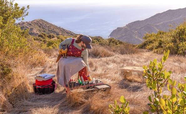
For the Catalina Island Conservancy, we developed species detection and distribution mapping systems using drone and camera-trap data across different habitat types. The resulting management-ready GIS layers accelerated habitat restoration planning by one full season, allowing the conservancy to prioritize restoration zones based on data-driven species presence analysis. Similarly, we collaborated with the Kauaʻi Forest Bird Recovery Project at the University of Hawaiʻi (working with Hawaiʻi DLNR) to monitor threatened forest bird populations in remote terrain. By processing survey imagery and camera-trap sequences, we delivered detection datasets and habitat overlays that inform ongoing conservation decisions for these critically endangered species.
Supporting the U.S. Fish and Wildlife Service's Pacific Islands Fish and Wildlife Office, we deployed detection and trend-analysis pipelines across multi-year imagery archives to monitor endangered species across island habitats. The system produces count trends, change detection analysis, and management maps that directly inform federal protection actions and recovery strategies.
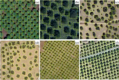
We partnered with the Federal Competitiveness and Statistics Authority to create the first machine-verified, nationwide inventory of palm trees and greenery from satellite imagery. Processing over 2.4 million satellite images, we delivered a complete country-wide survey in just 4 weeks—a task that would have taken 6 months using traditional methods. The system geolocated over 200,000 individual palm trees and calculated precise greenery surface area estimates (in m²), providing executive-ready data for national policy and environmental planning. Survey costs were reduced by 60-80% compared to manual methods.
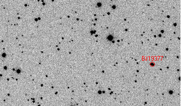
We even contributed to space science through the International Astronomical Search Collaboration, building automated candidate discovery systems for asteroid identification from telescope image sequences. Our moving-object detection system expanded their search capacity by 3×, helping identify potential near-Earth objects.
These projects demonstrate how responsible AI can shorten the observation-to-action loop. Faster detection means faster response. Lower costs mean broader coverage. Automated systems free experts to focus on decisions rather than data processing—and real conservation outcomes follow.
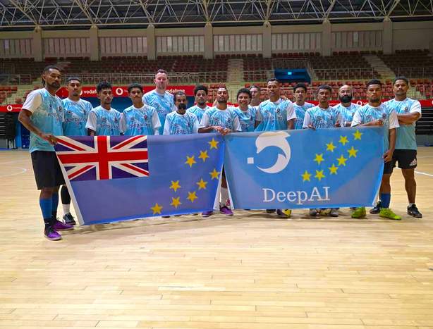
We also support communities facing unique challenges. In 2025, DeepAI became the major sponsor of Tuvalu's national futsal team, helping them return to international competition after a 14-year absence. Despite training on an airport runway due to limited infrastructure and facing the realities of climate vulnerability, the team's determination inspired us. This is what AI for Good means to us—using technology and resources to create opportunities and inspire hope, whether through conservation science or grassroots sports development.
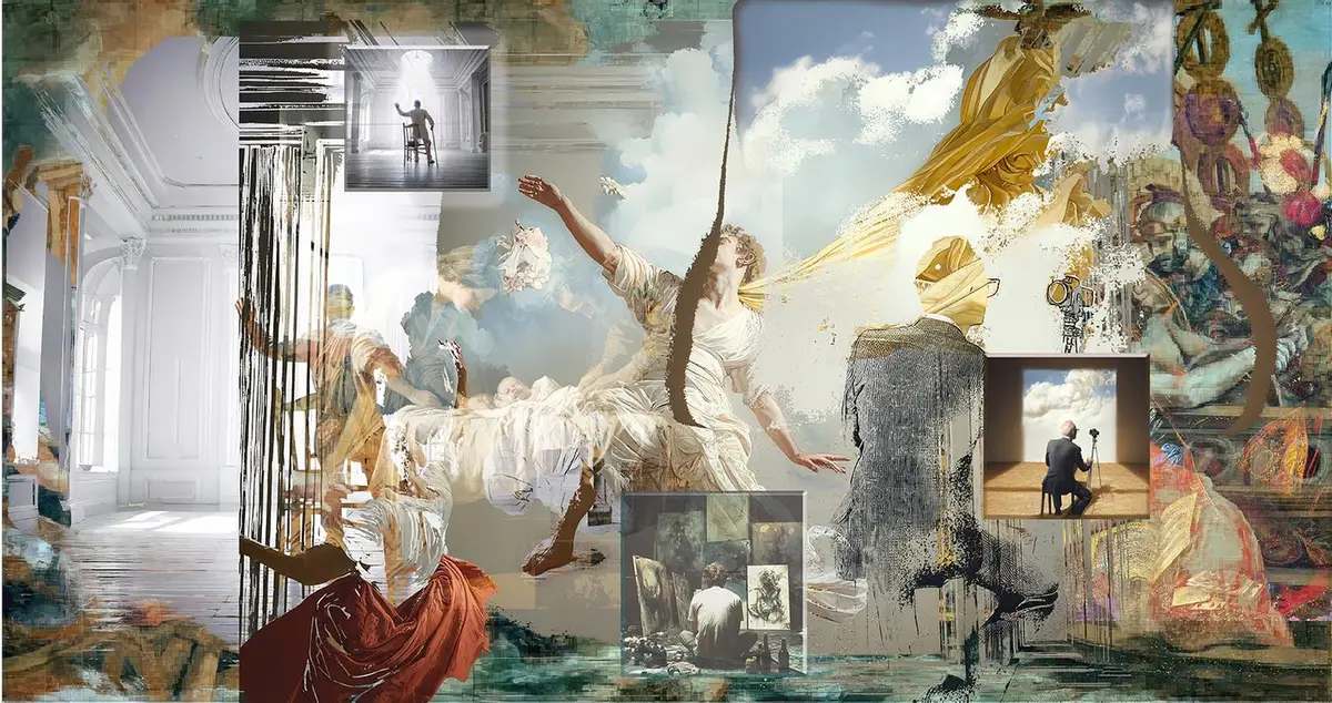
DeepAI is proud to be both a sponsor and creative partner of Making Our Miracles, a digital art exhibition featured in the 7th edition of The Wrong Biennale (November 2025 – March 2026). The project collects anonymous stories of love, healing, and transformation from around the world, which digital artists then interpret using AI-assisted tools into contemporary artworks inspired by the tradition of ex-voto devotional art. Artists like Clayton Campbell used DeepAI's text-to-video tools to generate visuals directly from submitted miracle stories—embracing AI not just as a production tool, but as a creative collaborator where unexpected outcomes become part of the artistic journey.
At DeepAI, we're building tools that democratize creativity while actively contributing to a better world. That's the kind of company we want to be.
Use your Google Account to sign in to DeepAI